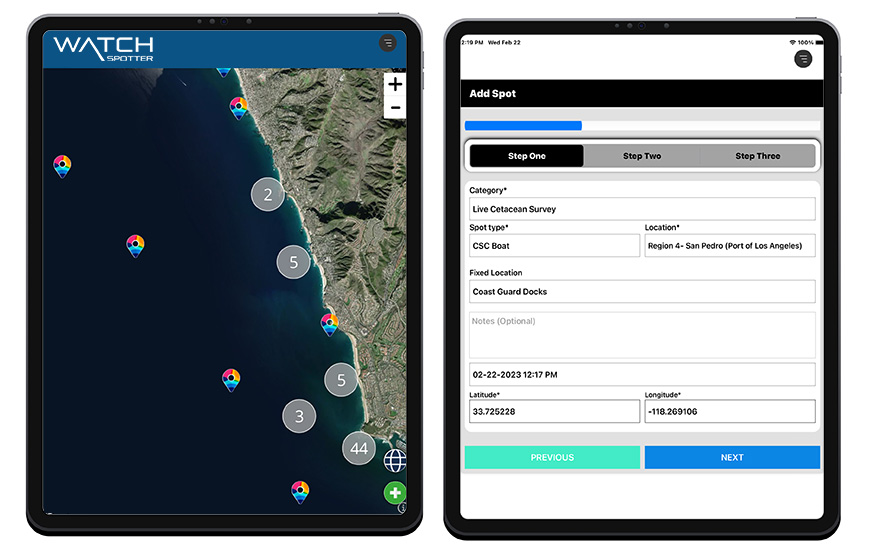
WatchSpotter™ is a feature-rich application loaded with the tools you need to manage all elements of a successful project.
Sighting Maps
All sightings (spots) are automatically mapped in real-time. There are multiple map styles to use to help analyze your data, including satellite maps, light, dark, general purpose outdoor, heat maps and bathymetric maps. All "Spot" data, including photos and audio files, is available on the map by clicking on the geo-marker.
Map Filtering
All maps have a dynamic filter that enables the user to filter their data by any data point, date range, or type of sighting. Combine this with our category count, which enables you to see the number of objects/animals within a sighting. Perfect for comparing quantity vs effort.
Route Tracking
Track the route or survey area you travel and add spots along the way.
Filter the map and add track route overlay.
Filter the map and add track route overlay.
Shared Map
You have the ability to share maps and sighting data. As an option you can share all sightings in a view-only mode on a shared map without needing credentials. Shared maps include the ability for login and add data. This is a great feature for collaboration or embedding on your website.


Weather Data
Satellite weather data is available on WatchSpotter Pro and EV. The data can automatically be added to every spot. 15 weather covariates are pulled for the coordinates and the date and time of the spot including both local and marine weather.
Data Visualization
Gain a more in-depth understanding of your entire data set with new insights into data trends, relationships, spatial trends, and hot spots.
Data Analytics
Analytics charts and graphs are available for all data points automatically.
Data Security
WatchSpotter™ is committed to protecting the privacy of our clients and their data with robust security standards.
Mobile App - Phone and Tablet
The mobile app is the key to the WatchSpotter solution. Mobile-first advanced technology embodies features that are extremely easy to use, and incredibility powerful. Sightings taken with the mobile data collection app are available in real-time. Available for both Apple IOS and Android.
Languages Translation Technology
WatchSpotter utilizes state-of-the-art translation technology. Making our web and mobile apps ready for virtually anywhere on the planet.
Digital Field Guide
A digital field guide (information center) provides project specific instructions, species identification and any pertinent contact information for projects requiring a hotline or “in case of sick or injured” numbers.
Offline Mode
Spots can be recorded while out in the field when no internet or cell service is available. Once service is reestablished, spots will automatically upload.
For extreme accuracy while offline, a Bluetooth satellite GPS integration is also available.
For extreme accuracy while offline, a Bluetooth satellite GPS integration is also available.


SpotterNet™
SpotterNet is a global text messaging platform designed by WatchSpotter to enable real-time communications between the project administrators and the people in the field. The A2P (Application to Person) technology enables administrators the ability to send one-to-one text messages or mass text messages to a group. Mass text messages can be scheduled or sent immediately. Keyword automation (auto-reply) is also available within the platform.
Perfect for dispatch, alert systems, stranding notifications and more.
Perfect for dispatch, alert systems, stranding notifications and more.

